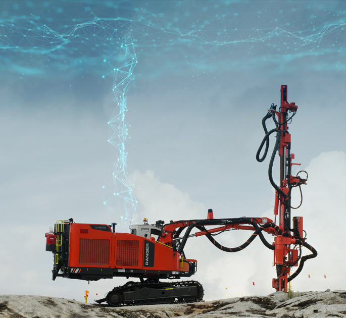
Xsite DRIll
3D Machine Control System
for Surface Drills
Work easier, faster, and safer with Xsite® Machine Control!
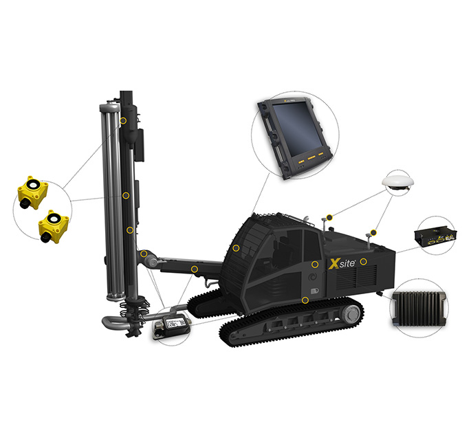
Xsite® DRILL is a high-precision satellite-based drilling and hole navigation system that helps the drill operator to navigate to the correct hole position and assists in achieving the correct drilling angles and depth quickly and safely.
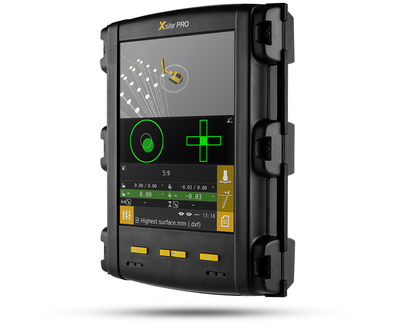
The easy-to-use and intuitive user interface, real-time information, and professional local support guarantee the best possible user experience.
The Xsite® DRILL system can be installed on nearly any TH (Top Hammer) and DTH (Down The Hole) surface drills.
Save time and increase hole quality
Machine Control helps to eliminate positioning and orientation errors. The system guides the operator to navigate to the right hole and reach the right depth with correct inclination.
Fast and Accurate Documentation
Wireless data transfer and cloud connection speed up the drilling process and enable real-time documentation and reporting of work.
Savings on total cost of ownership
Xsite Machine Control improves the efficiency of the entire production chain and reduces overall operating costs (TCO).
Optimized Drilling with Xsite® DRILL
The Xsite® DRILL system enables you to perform your work faster and more accurately.
Assistive features such as automatic selection of the nearest hole and the machine’s boom reach indicator help the drill operator navigate to the right hole quickly, accurately, and effortlessly.
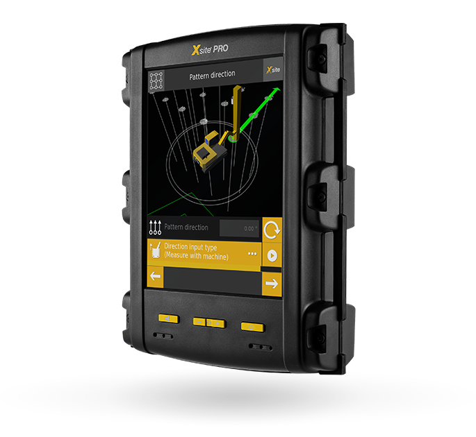
No Drill Plan? No Problem!
With Xsite® DRILL the drill operator can create a drill plan from scratch without leaving the cabin.
This speeds up the blasting process remarkably – No need for manual hole markings or waiting for a surveyor to visit the site.
A built-in guide helps you through the process step-by-step, so you won’t have to use your time browsing manuals.
Wireless data transfer for designs and as-built
A surface model, design model, or drill plan created with design software can be transferred wirelessly from the office to the Xsite® system as a file or as GPS coordinate points, using the Xsite® MANAGE cloud service.
With a two-way wireless connection, as-built data can be sent back to the office for review or quality control.
Features
- Large 8,4″ touchscreen with clear graphics
- Accurate GNSS satellite positioning
- Drill plan wizard
- Auto-stop to target depth
- Wireless data transfer
- Support for IREDES, LandXML and .dxf file formats
- Easy documentation of work (as-built)
- Remote support