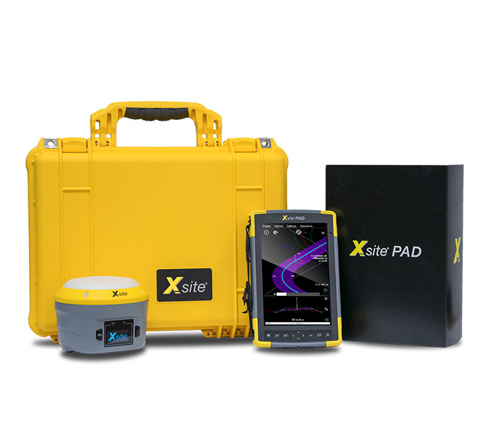
Xsite® pad
Worksite tablet for worksite managers and surveyors.
Easier and faster worksite management
The Xsite® PAD system contains the same top features as the Xsite® PRO 3D machine control system, but its functions are designed for the needs of surveyors and worksite management.
The user interface and features follow the same principles as Xsite’s 3D machine control system, which eases the communication between managers and machine operators.
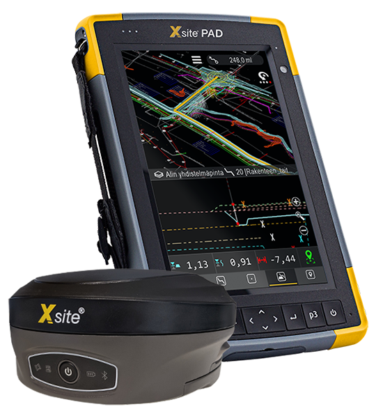
The Xsite® PAD system includes LANDNOVA X software and Xsite® ROVER smart antenna.
Make terrain markings
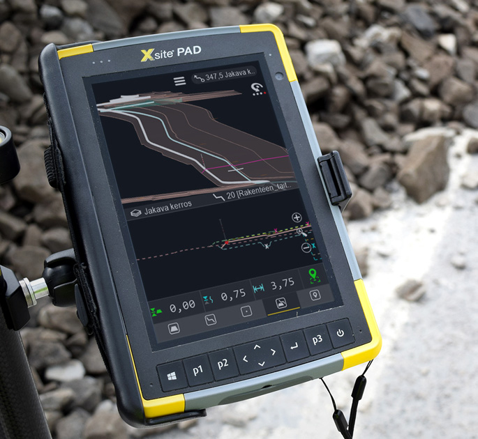
With the Xsite® PAD system, you can mark temporary traffic arrangements, storage areas, detour routes etc. You can also perform surveying tasks yourself with centimeter accuracy and decrease idle time on site.
Create 3D models on site
The built-in model tool of the Xsite® PAD enables you to create simple 3D models of building foundations or temporary structures such as storage areas, for example.
Share project data
The point data collected with 3D machine control is displayed on the screen of the Xsite® PAD. Also, self-created 3D models and points can be synchronized to machine control via the Xsite® MANAGE cloud service.
“Xsite® PAD is like a 3D machine control system for worksite managers and surveyors”
Leveraging the latest technologies, the Xsite® PAD comes with Xsite® ROVER, a smart GNSS receiver of the next generation. The proven and outstanding performance and reliability make it the preferred choice of surveyors and construction professionals.
Features
Data transfer
- Xsite MANAGE -Cloud platform
- Infrakit compatible
- Gemini compatible
- Bluetooth 4.0 (+EDR, BLE-support)
- WiFi (2.4GHz and 5GHz)
- 4G LTE
Supported file formats
- 2D maps: DXF
- Points: DXF, XML, GT, SCV, KOF, PXY
- Lines: VGP, SBG, XML, Anpakke
- Surfaces: DXF, XML